Property Record
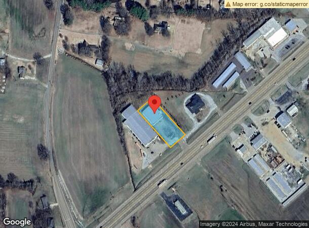
1167 Highway 51 N, Ripley, TN 38063
NEARBY LISTINGS FOR SALE OR LEASE
Property Detail
1167 Highway 51 N
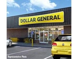
Storebuilding
DISTRICT: 02 DOLLAR GENERAL, COUNTY AREA: R90
X
Lauderdale
47097C0218D
Tennessee
2023
0.82 AC
2023
Tennessee West Area
050503
Other Market Areas
8,480 SF
076A-A-002.01
DEMOGRAPHICS near 1167 Highway 51 N
1 Mile
3 Mile
5 Mile
2024 Total Population
667
7,993
12,195
2029 Population
654
7,902
12,051
Pop Growth 2024-2029
(1.95%)
(1.14%)
(1.18%)
Average Age
40
39
40
2024 Total Households
283
3,290
4,977
HH Growth 2024-2029
(2.12%)
(1.28%)
(1.31%)
Median Household Inc
$64,853
$41,967
$43,024
Avg Household Size
2.40
2.30
2.40
2024 Avg HH Vehicles
2.00
2.00
2.00
Median Home Value
$142,857
$125,465
$120,320
Median Year Built
1999
1980
1982
Nearby Places
- Restaurants
- Banks
- Shops
- Fitness
- Groceries
Nearby Properties
Address
Land Use
TOTAL SIZE
Lot Size
Zoning
Address
Land Use
TOTAL SIZE
Lot Size
Zoning
100,484 SF
95.04 AC
M2
Address
Land Use
TOTAL SIZE
Lot Size
Zoning
102,205 SF
27.10 AC
R2
Address
Land Use
TOTAL SIZE
Lot Size
Zoning
103,875 SF
24.54 AC
R2
Address
Land Use
TOTAL SIZE
Lot Size
Zoning
577,400 SF
51.70 AC
M2
Address
Land Use
TOTAL SIZE
Lot Size
Zoning
44,606 SF
24.28 AC
Address
Land Use
TOTAL SIZE
Lot Size
Zoning
39,238 SF
24.82 AC
M2
Address
Land Use
TOTAL SIZE
Lot Size
Zoning
70,568 SF
23.73 AC
M2
Address
Land Use
TOTAL SIZE
Lot Size
Zoning
119,245 SF
23.08 AC
B2
Address
Land Use
TOTAL SIZE
Lot Size
Zoning
28,664 SF
4.31 AC
R1
Address
Land Use
TOTAL SIZE
Lot Size
Zoning
4,944 SF
6.02 AC
R4
Address
Land Use
TOTAL SIZE
Lot Size
Zoning
30,684 SF
0.28 AC
B3
Address
Land Use
TOTAL SIZE
Lot Size
Zoning
74,859 SF
25.22 AC
Address
Land Use
TOTAL SIZE
Lot Size
Zoning
20,940 SF
4 AC
B2
Address
Land Use
TOTAL SIZE
Lot Size
Zoning
3,268 SF
48.84 AC
R4
Address
Land Use
TOTAL SIZE
Lot Size
Zoning
22,204 SF
0.32 AC
B3
Address
Land Use
TOTAL SIZE
Lot Size
Zoning
17,868 SF
4 AC
R2
Address
Land Use
TOTAL SIZE
Lot Size
Zoning
37,400 SF
5.94 AC
B2
Address
Land Use
TOTAL SIZE
Lot Size
Zoning
51,220 SF
5 AC
B2
Address
Land Use
TOTAL SIZE
Lot Size
Zoning
2,892 SF
5.99 AC
R1
Address
Land Use
TOTAL SIZE
Lot Size
Zoning
8,625 SF
2.57 AC
B3
Address
Land Use
TOTAL SIZE
Lot Size
Zoning
50,678 SF
7.89 AC
B2
Address
Land Use
TOTAL SIZE
Lot Size
Zoning
212,884 SF
14.59 AC
M2
Address
Land Use
TOTAL SIZE
Lot Size
Zoning
9,376 SF
2.90 AC
B2
Address
Land Use
TOTAL SIZE
Lot Size
Zoning
148,727 SF
46.49 AC
M2
Address
Land Use
TOTAL SIZE
Lot Size
Zoning
9,572 SF
0.60 AC
R3
Address
Land Use
TOTAL SIZE
Lot Size
Zoning
20,161 SF
3.38 AC
H
Address
Land Use
TOTAL SIZE
Lot Size
Zoning
7,732 SF
2.33 AC
M2
Address
Land Use
TOTAL SIZE
Lot Size
Zoning
Address
Land Use
TOTAL SIZE
Lot Size
Zoning
40,810 SF
13.97 AC
B2
Address
Land Use
TOTAL SIZE
Lot Size
Zoning
10,428 SF
3.30 AC
B2
The World's #1 Commercial Real Estate Marketplace
Connect with us
© 2025 CoStar Group
The information above has been obtained from sources believed reliable. While we do not doubt its accuracy we have not verified it and make no guarantee, warranty or representation about it. It is your responsibility to independently confirm its accuracy and completeness. Any projections, opinions, assumptions, or estimates used are for example only and do not represent the current or future performance of the property. The value of this transaction to you depends on tax and other factors which should be evaluated by your tax, financial, and legal advisors. You and your advisors should conduct a careful, independent investigation of the property to determine to your satisfaction the suitability of the property for your needs.